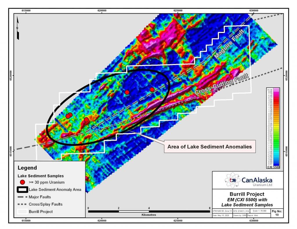

CanAlaska’s Burrill property, totaling 5,601 ha, is located 60 km from the northeastern margin of the present-day Athabasca Basin, Saskatchewan, Canada. The Burrill project is part of CanAlaska’s NE Wollaston land package, where the main target is basement-hosted uranium deposits similar to Eagle Point or Arrow. The property is located Southeast of the Kingston Project covering the interpreted extension of the Maguire Fault and the cross-structures associated with the Warren Project. Strong EM conductors occur across the property in connection with the Maguire Fault trend and the east-northeast trending cross-cutting structures. The Burrill Project represents an area of interaction between conductor and fault trends and is coincident with anomalous lake sediment samples and uranium showings. This area has never been drill-tested. The company is actively seeking joint-venture partners for its Burrill project.