Project
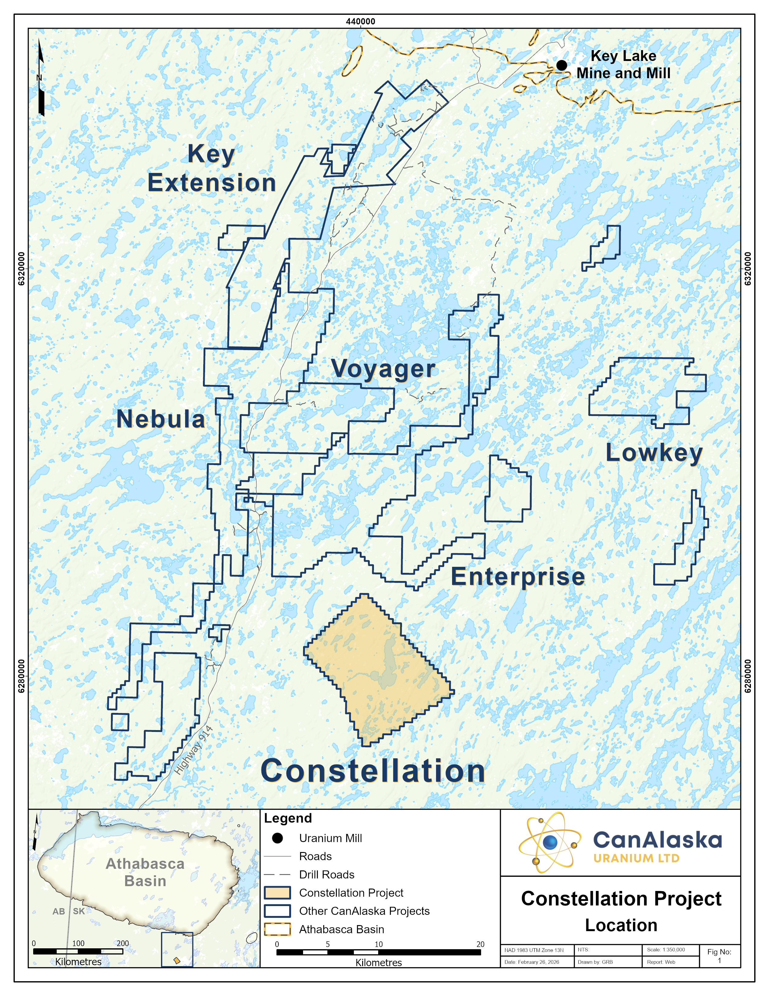
CanAlaska’s Constellation property, totaling 11,142 ha, is located in the southeastern Athabasca Basin. The project is sixty kilometres south of the present-day Athabasca Basin edge and the Key Lake Mine and Mill complex along Highway 914. Historical exploration on the project consists of prospecting and geological mapping that were completed in conjunction with airborne radiometric, electromagnetic, and magnetic surveys. These historical surveys identified electromagnetic conductors associated with magnetic lows that flank magnetic highs, which is an analogous geological framework for Athabasca style uranium deposits.
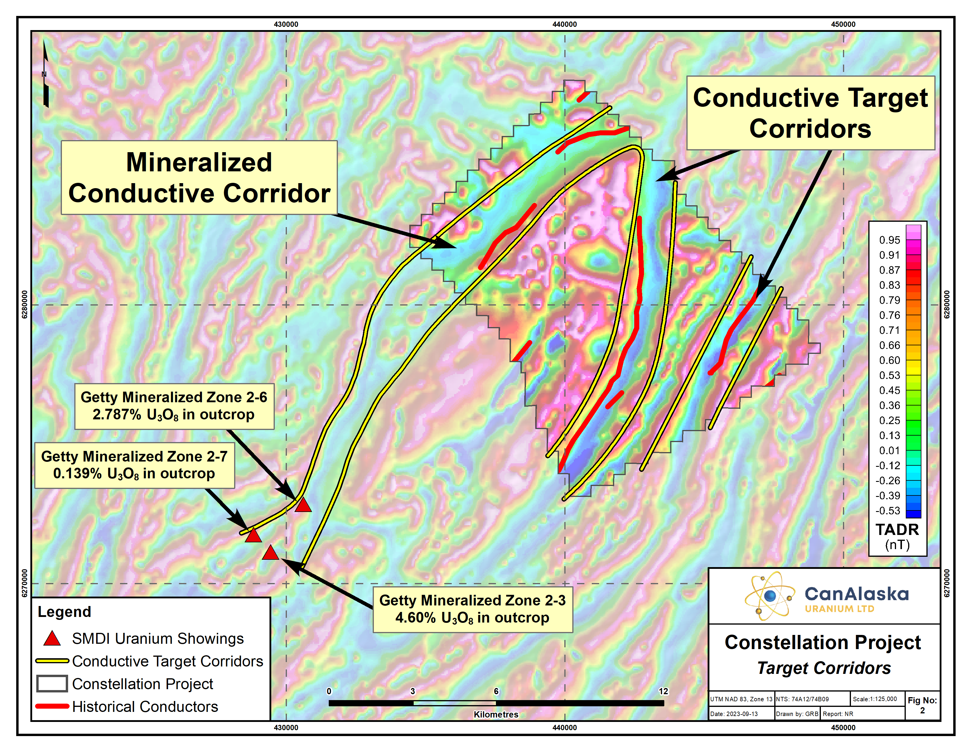
These geophysical surveys were followed by geological mapping and wide-spaced prospecting programs both on Property and along trend to the south. Prospecting along trend identified outcrop-hosted high-grade uranium mineralization in Getty-Minerals Zones 2-6 and 2-3, located approximately 10 kilometres from the project boundary. These showings returned uranium mineralization from grab samples in outcrop grading 2.787% U3O8 and 4.60% U3O8. The mineralized magnetic low corridor along which the Getty-Minerals Zones are hosted trends onto the Constellation project. In the early 2000’s, geological mapping and geochemical sampling on the project confirmed the magnetic high is a central core of Archean gneiss which is flanked by graphitic metasediments. In addition, structural lineaments in the magnetic lows were interpreted, and may represent large scale faulting.
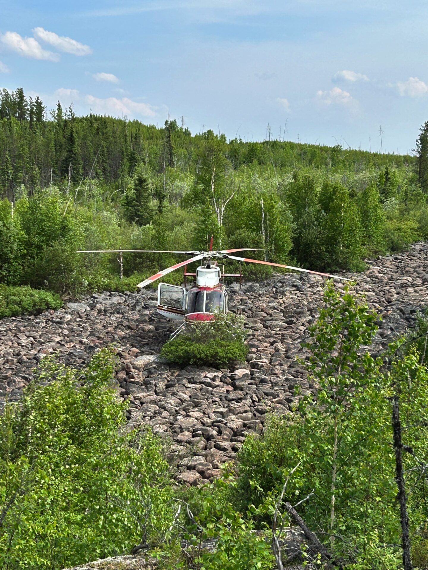
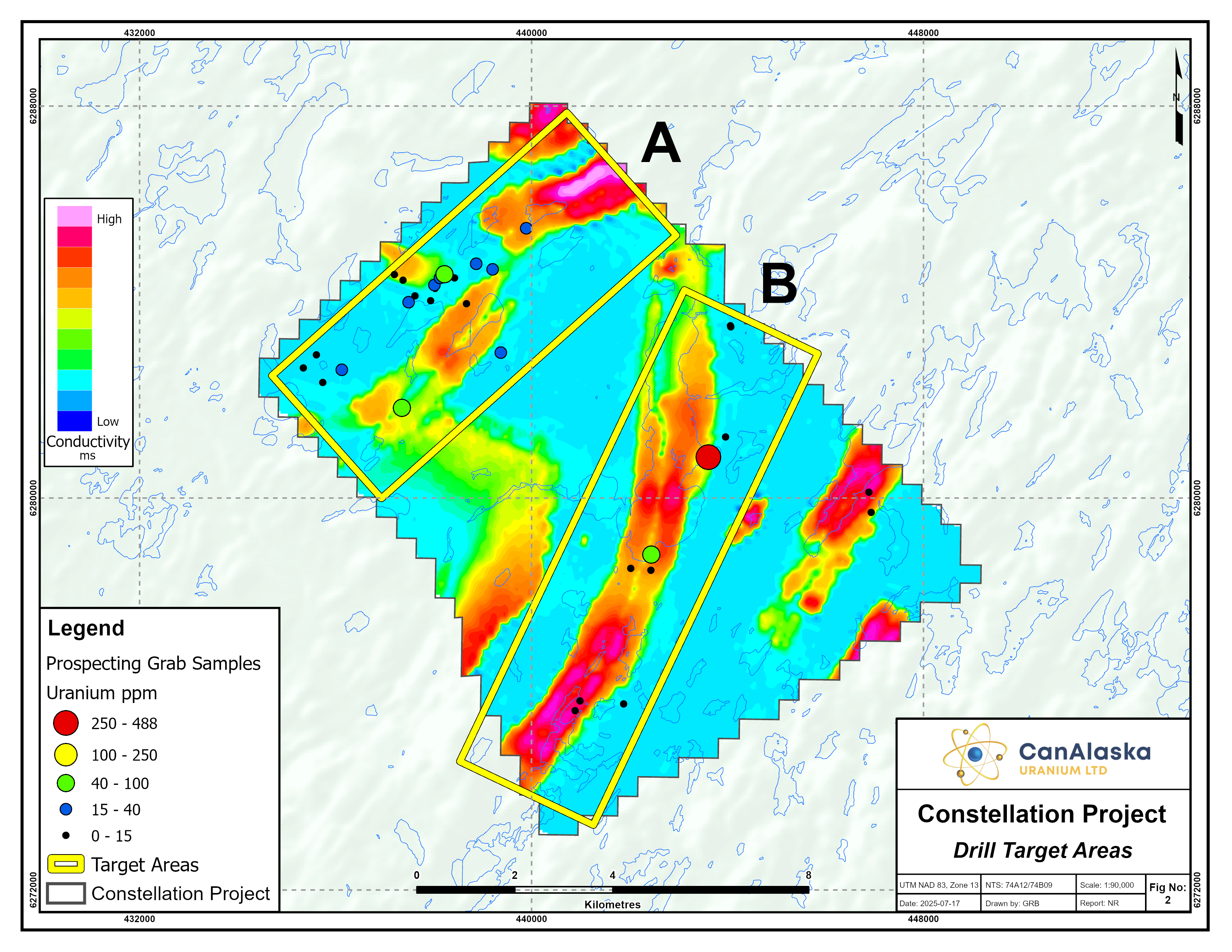
The Company recently completed a project wide VTEM survey. The goal of the survey was to identify and prioritize basement conductors, characterize lithological and alteration variations, and map the structural setting of the project to support future drill targets. The Company completed a ground-prospecting program in 2024 that identified anomalous uranium and alteration in two key target areas. The Company subsequently completed a small drill program to test a few of these results.
The Company believes the central Archean gneiss core forms a structural lozenge or competency contrast which may create important conduits and structural traps for hydrothermal activity and the deposition of uranium. The northeast-southwest oriented magnetic lows represent three target corridors with the potential for structural re-activation. In total, the Constellation project contains over 18 kilometres of untested prospective target area. The Company is currently seeking Joint Venture partners to advance the Constellation project.
CanAlaska Uranium Ltd.
Unit 204, 75-24th Street East Saskatoon,
SK S7K 0K3
Copyright © 2012 - 2026 CanAlaska Uranium Ltd.
