Location
The Strong Extension (14,309 ha), Moak North (6,025 ha) and Wilson (5,272 ha) are three Mineral Exploration Licenses applied for in October 2021, based on the data from a 2008 VTEM survey obtained by CanAlaska. They are located 35km northwest of Thompson, adjacent to highway 320.
Geology
The geology from the TNB compilation has been extended and revised based on the detailed magnetics of recent surveys, the distribution and strength of VTEM anomalies, combined with a review of historical drill holes (Figure 1).
Historical Exploration
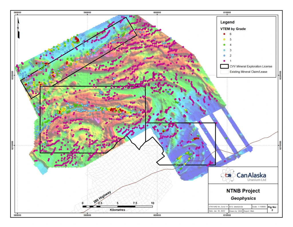
The project area was explored by a variety of companies in the 1950’s to the 1970’s. In 2001-2004 Anglo-American (HBED) carried out airborne and ground geophysical surveys followed by drilling. Several of these drill holes intersected Ospwagan and/or ultramafics confirming the extension of the Thompson Nickel Belt to this area. A 2008 VTEM survey covered this area but there was no follow-up despite the abundance of anomalies (Figure 2)
CanAlaska Work
CanAlaska has compiled the VTEM electromagnetic anomalies of the 2008 survey and revised the geological map using the magnetic and electromagnetic data taking into consideration the historical drill hole data. Work is ongoing to develop drill targets.
Potential
Each of these three MELs have the potential for several deposits similar to Thompson, Birchtree, or Pipe.